Makó é uma pequena cidade húngara, junto à fronteira com a
Roménia e a cerca de 100 km de Timisoara, cidade proeminente da
região.
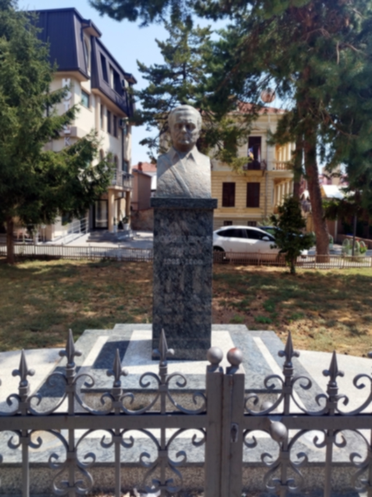
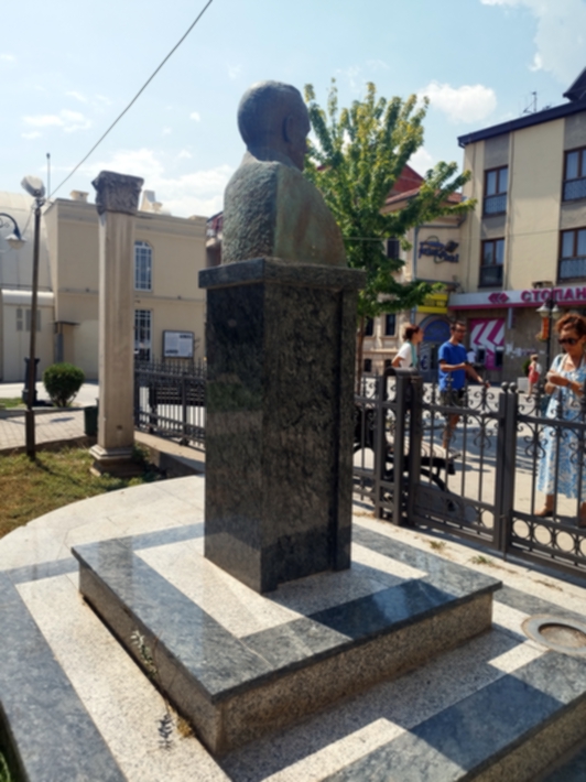
Apresenta uma boa quantidade de obras de statua urbana em relação
à sua demografia de 22.514 habitantes, estimada em 2019. Com
efeito, apresenta composições militares com estátua,
homenagens aos caídos, dois encorpados conjuntos estatuários de
individualidades políticas junto ao parlamento local, estátuas
de artistas, músicos, uma sequência de bustos ao longo de um
alpendre, estátua equestre historicista. Mas, aquela que mais
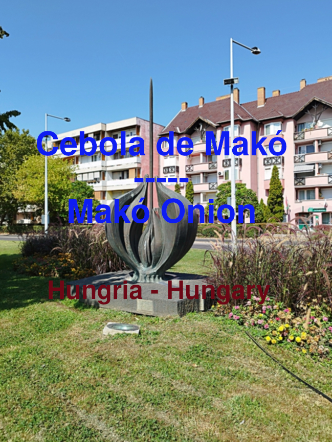
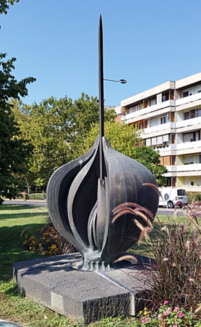
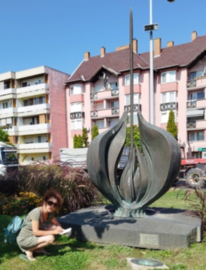
nos sobressaiu foi a "Cebola de Makó", uma obra única
na representação estatuária do vegetal!
A Cebola de Makó é uma obra de elevada mestria escultórica.
Junta o conhecimento naturalista da forma da cebola, dos cortes e
do desfolhar com o simbolismo na geometria vertical da haste do
rebento. E só com uma qualidade destas é possível estarmos no
outro lado da rua e virmos logo o que alguém exclamou: olhem,
está ali a estátua de uma cebola!
Claro que é logo evidente, se eles têm aqui uma estátua de uma
cebola é porque tem lá boas cebolas. É a mesma estrutura
significante da estátua da vaca leiteira de Leuwarden, nos
Países Baixos. Assim, a representação estatuária documenta o
que há de melhor na região, há regiões da vaca leiteira, há
regiões da cebola, há regiões do vinho, há regiões da pesca,
e até do choco frito, em Setúbal, onde o rio Sado é aí
conhecido pelo rio do choco devido à sua abundância e
qualidade.
Esta belíssima representação vegetalista da Cebola de Makó é
obra do escultor Ferenc Sütő e é do ano 2000.
Tem na sua base a inscrição “Készült a makói polgárok
akaratából és abban a reményben, hogy a makói hagyma van,
volt, lesz.", que significa “Foi feito pela vontade dos
cidadãos de Makó e na esperança de que a cebola de Makó
exista, ontem, hoje e amanhã”.
A sua edificação foi baseada em decreto do governo local Obras
de arte públicas sob proteção local: Hagymaszobor Kálvin
utca-Szegedi utca hr.: 4669/2 Informações: mako.hu - condado de
Csongrád-Csanád, Makó, esquina de Kálvin utca e Szegedi utca.
|
Makó is a small Hungarian town, close to the border with Romania
and about 100 km from Timisoara, a prominent city in the region.
It presents a good number of urban statue works in relation to
its demographic of 22,514 inhabitants, estimated in 2019. In
fact, it presents military compositions with statues, tributes to
the fallen, two large statuary sets of political individuals next
to the local parliament, statues of artists , musicians, a
sequence of busts along a porch, historicist equestrian statue.
But the one that stood out the most to us was the "Onion of
Makó", a unique work in the statuary representation of the
vegetable!
Makó's Onion is a work of high sculptural mastery. It combines
naturalistic knowledge of the onion's shape, cuts and defoliation
with the symbolism in the vertical geometry of the shoot's stem.
And only with quality like that is it possible to stand on the
other side of the street and immediately see what someone
exclaimed: look, there's a statue of an onion!
Of course it's immediately evident, if they have an onion statue
here it's because they have good onions there. It is the same
significant structure as the Leuwarden milk cow statue in the
Netherlands. Thus, the statuary representation documents what is
best in the region, there are dairy cow regions, there are onion
regions, there are wine regions, there are fishing regions, and
even fried cuttlefish, in Setúbal, where the Sado river is
there. known for the cuttlefish river due to its abundance and
quality.
This beautiful vegetal representation of the Makó Onion is the
work of sculptor Ferenc Sütő and is from the year 2000.
It has at its base the inscription “Készült a makói polgárok
akaratából és abban a reményben, hogy a makói hagyma van,
volt, lesz.", which means “It was made by the will of the
citizens of Makó and in the hope that the Makó onion exists ,
yesterday, today and tomorrow”.
Its construction was based on a
local government decree Public works of art under local
protection: Hagymaszobor Kálvin utca-Szegedi utca hr.: 4669/2
Information: mako.hu - Csongrád-Csanád county, Makó, corner of
Kálvin utca and Szegedi utca.
|
Makó e Budapeste foram as cidades registadas na Hungria. Em makó
foi efectuado o levantamento da quase totalidade das obras de
statua urbana. Em Budapeste observámos o parque estatuário
Memento Park, iniciativa de grande valor democrático e cultural
de que muitos hungaros se orgulham.
Efetuámos também fotografia noturna de statua urbana em
Budapeste, onde se pode observar os recortes e ambientes criados
pela iluminação artificial na obra.
Num breve rastreio sistemático entre as duas margens do Danúbio
observaram-se boas composições em pedra e em bronze, onde se
realça um conjunto de rapazes a jogar ao berlinde, ou
equivalente e uma rapariga brincando com uma bola na boca do seu
cão. obras de grande sensibilidade e beleza com uma notavel
qualidade do bronze.
Mais sobre statua urbana na
Hungria
|
Makó and Budapest were the cities registered in Hungary. In
makó, almost all urban statue works were surveyed. In Budapest
we see the Memento Park statue park, an initiative of great
democratic and cultural value that many Hungarians are proud
of.
We also carried out night photography of an urban
statue in Budapest, where you can observe the cutouts and
environments created by the artificial lighting in the work.
In
a brief systematic survey between the two banks of the Danube,
good compositions in stone and bronze were observed, highlighting
a group of boys playing marbles, or equivalent, and a girl
playing with a ball in her dog's mouth. works of great
sensitivity and beauty with remarkable quality of bronze.
More about
urban statues in Hungary
|